Ompompanoosuc River Parcel #2
Property Details
Property Overview
The ownership is selling their property in two separate parcels, divided by the town line. The +/-60 acre Strafford parcel is well suited to future home development with paved town road frontage and roadside electric service. The +/-220 acre Thetford parcel is well suited to a camp or seasonal off-grid home development with beautiful local views.
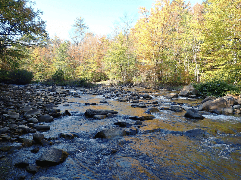
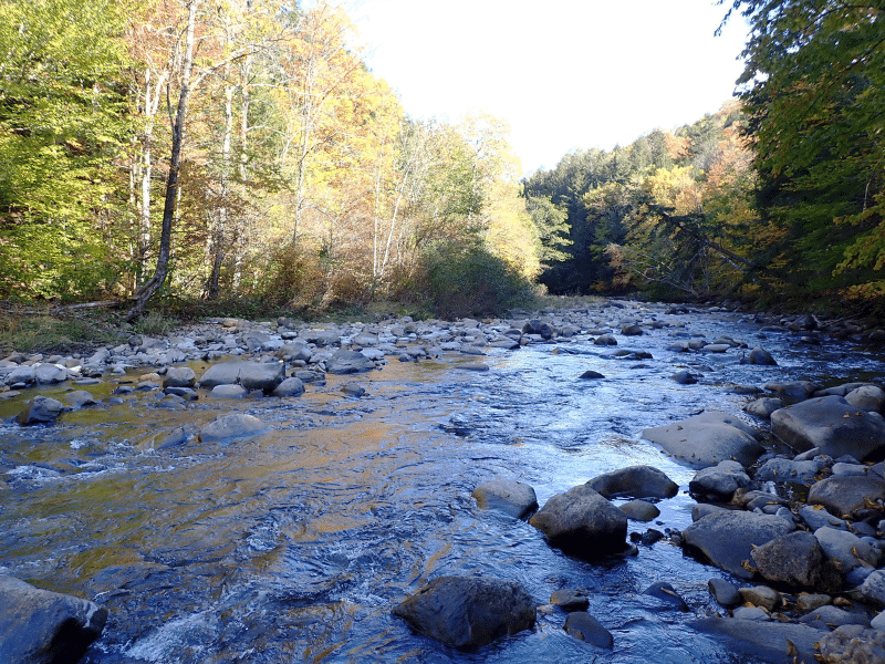
Both parcels have significant frontage along the West Branch of the Ompompanoosuc River. Both parcels have Restricted Use Areas associated with the reclaimed Elizabeth Copper Mine site.
Location
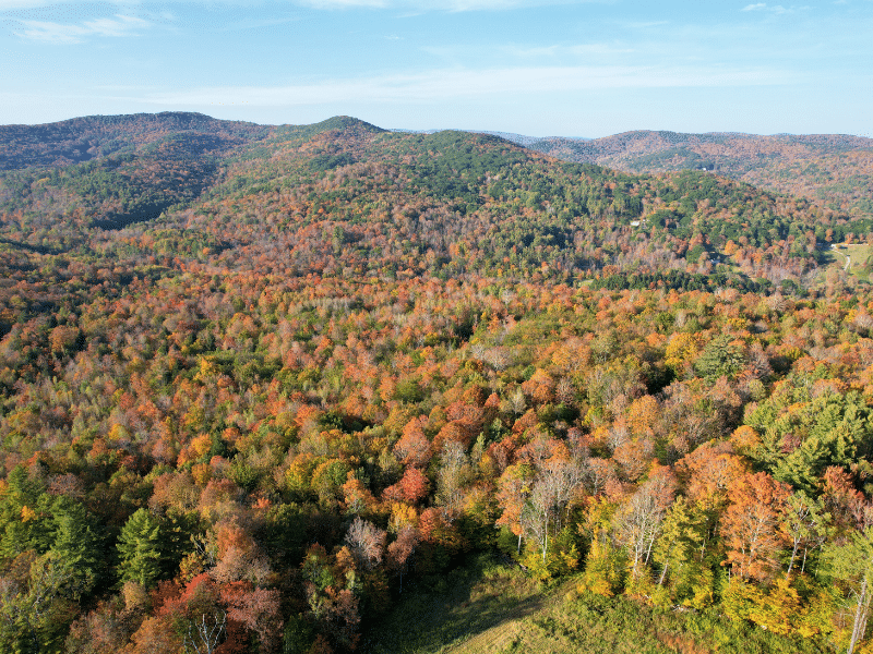
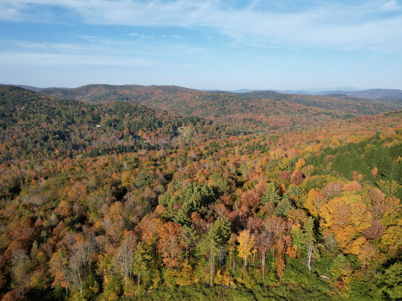
The parcels are situated in east central Vermont, 11 miles from the New Hampshire border. The local landscape is dominated by abundant forestland, with small farms in the valleys and widely scattered homes along roads. This area is part of the West Branch of the Ompompanoosuc River watershed, a sizable river that runs along both parcels.
The hamlet of South Strafford is 1.7 miles to the northwest and is host to a general store. Norwich, Vermont, located 10 miles to the south, is the closest large town offering the most amenities. Interstate 91 is just east of Norwich, and across the Connecticut River is the Town of Hanover, host of Dartmouth College. Boston is just over a 2 hour drive.
Access
The land is accessed from New Boston Road, a graveled, town maintained road. There is no electric power along this part of the road. A +/-400’ right of way road runs from the town road to the property boundary and gate. From the gate, a gravel road heads into the land in a northern direction for +/-2,325’ to the land’s open meadow and likely best camp location. From this point, the road continues through the land for another +/-3,950’ (this last section of the road will need some maintenance before it’s drivable again; however, much of the road is graveled & ditched).
Property Description
The land’s primary feature is its nearly 1/2 mile of river frontage at its northern end. Two old woods trails head to the river providing good access to this scenic water resource.
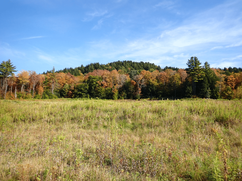
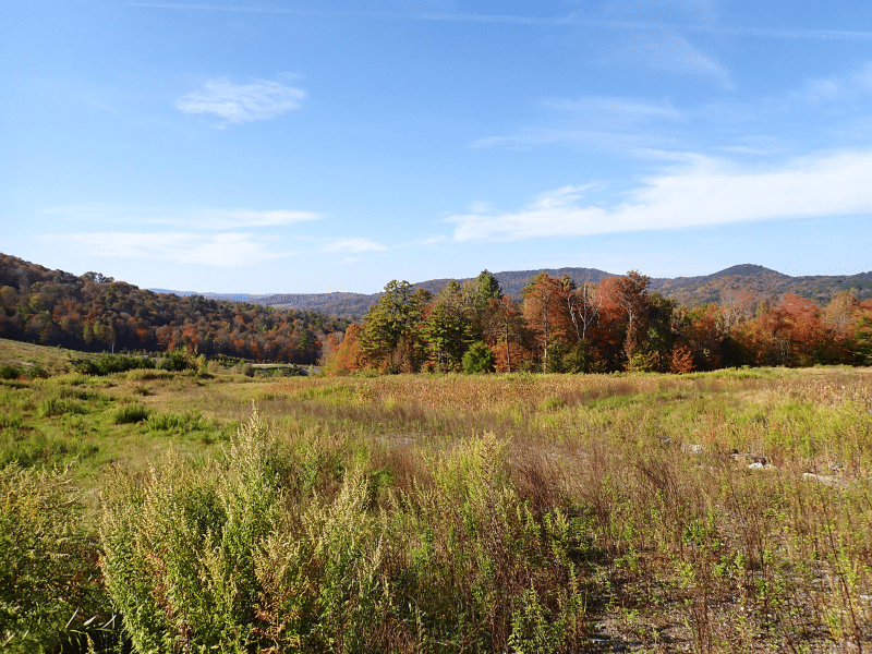
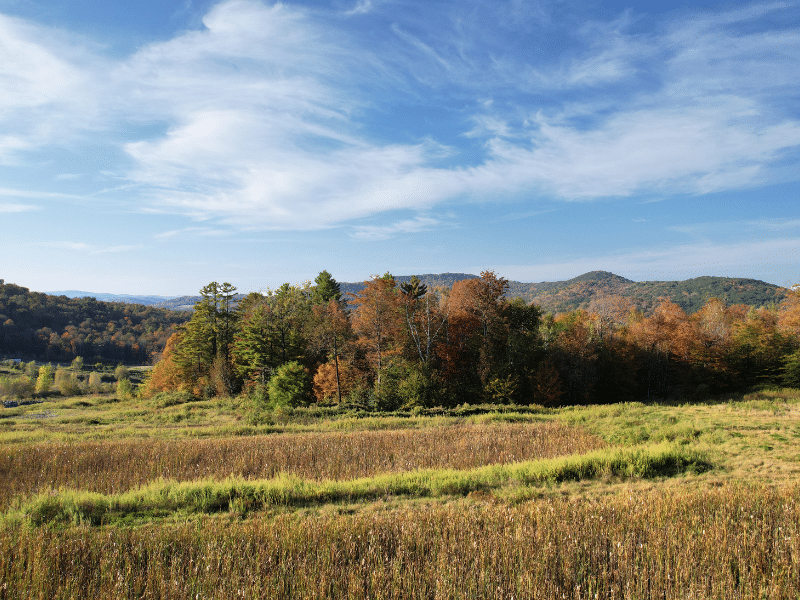
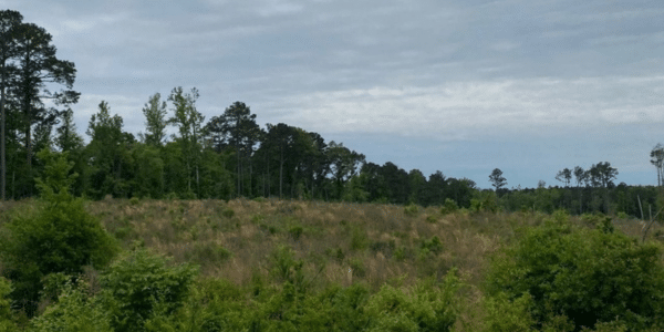
Given the land’s access, distance to electric power, Restricted Use Area, and opposing solar array, the highest and best use is likely a camp/seasonal home development, recreation, and/or forest management. A meadow at the end of the access road (see maps for location) offers attractive views to the west and north, a prime location to develop a large camp or seasonal home. There is a small woodland pond near the field that contains amphibians such as newts and frogs, and would be used for drinking water by deer and other animals in the forest.
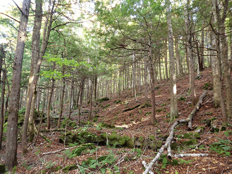
Elevations range from 730’ along the river to 1,200’ near the SE boundary. The terrain is mostly gently sloping, however, with steep terrain along the river.
Timber Resource
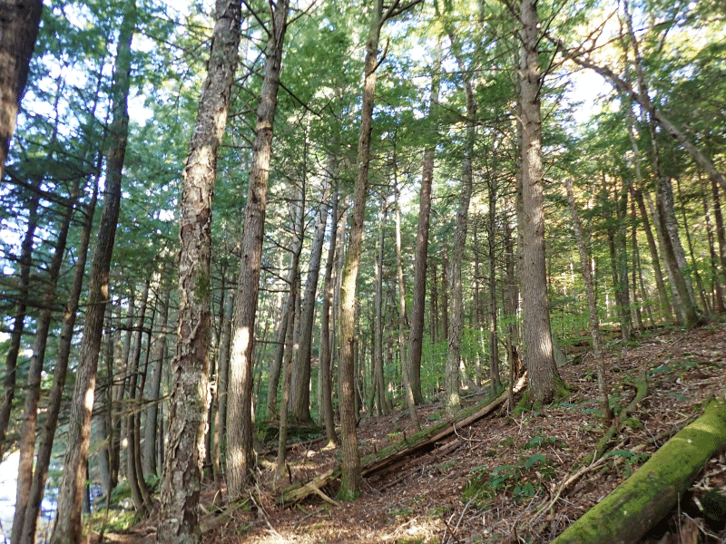
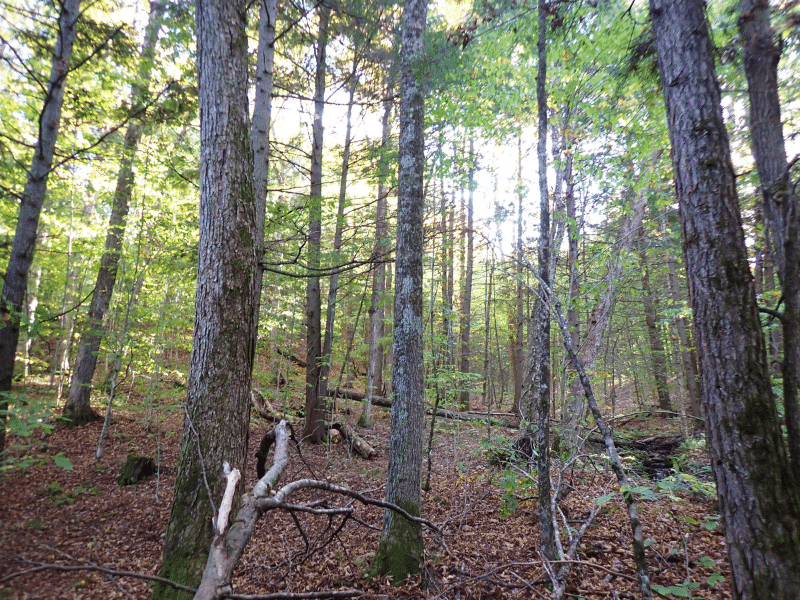
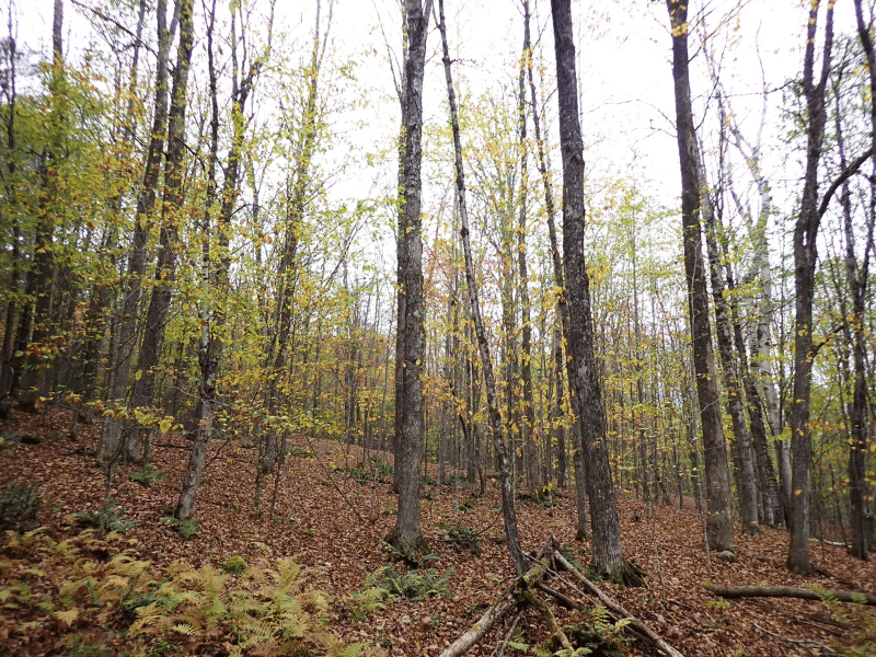
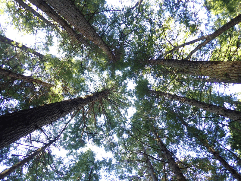
The forest can be considered aesthetically scenic as it has been several decades since forest management has occurred, resulting in a high canopy that’s easy to walk through. Generally, on the higher elevation and more level sites, northern hardwood species dominate. On the steeper slopes and along the river, dense hemlock stands are common, with large legacy trees throughout, holding diameters in the 18-24’ size class. The hardwood stands have a range of diameters, are fully stocked, and include large legacy stems. The youngest age class was created from harvesting that occurred +/-24 years ago.
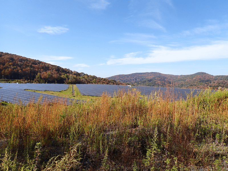
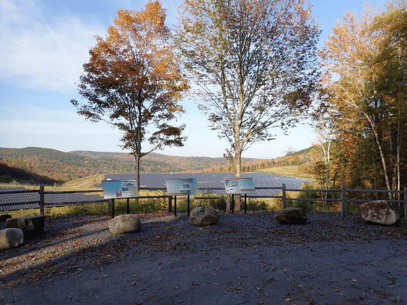
Solar Lease
Portions of the Restricted Area are occupied by a solar project operated by Greenwood Infrastructure, under a lease in which the lease period could remain for an additional +/-42 years. Annual lease income is $1.00. A copy of the lease agreement is available upon request.
Restricted Use Area
The property is part of the former Elizabeth Copper Mine whose reclamation and stabilization was finalized by the EPA. As part of EPA’s reclamation/remedial action plan, the land includes a Restrictive Use Area covering a total of 79 acres as represented on the property maps and survey. This area can not be developed or disturbed in the future per the Grant of Environmental Restrictions, Right of Access, and Easement deed. Copy provided upon request.
Parcel Map
Broker Disclosure: Under agency law, you are considered a customer, unless you have a written brokerage agreement with Fountains Land (in which case you are a client). While you are a customer, Fountains is NOT obligated to keep confidential the information that you might share with us; therefore, you should not reveal any information that could harm your bargaining position.

John Latham, CF
Vermont Real Estate Agent & Analyst
Contact John Latham
Resources
Maps
-
Google Earth IconGoogle Earth
-
Locus Map IconLocus Map
-
Topo Map IconTopo Map
-
IR Map IconIR Map
-
Photo Map IconPhoto Map
View Similar Properties
-
 AvailablePrice Varies By Parcel
Swanson Development
182 AcresMultiple UsesPerry, Houston County, GA -
 Available$105,000
Rolling Hills Ranch #36
11.95 AcresMultiple UsesPineland, San Augustine County, TX -
 Available$60,630
Powell Plantation Tract #1
4.042 AcresMultiple UsesDeBerry, Panola County, TX -
Available$38,310
Powell Plantation Tract #2
2.554 AcresMultiple UsesDeBerry, Panola County, TX