Maple Hill Parcel
Property Details
Property Overview
The property is ideally suited for development of a family homesite where an existing graveled road with buried electric run to a potential homesite. The land’s high elevation offers long views to the west with tree clearing. Easily accessible with short commutes to Plainfield Village and Montpelier, the location benefits from a quiet area with limited road noise.
Location
The land is located in the rural town of Plainfield, a bedroom community to the nearby Barre-Montpelier Cities. The area is a working landscape of family farms, managed forests, public lands and small villages. This region’s land use is nearly evenly divided between farm and forestland, with homes semi-widely scattered. The 26,000-acre Groton State Forest occupies the eastern end of the town, with the Spruce Mountain Trailhead 3 miles to the east. The capital city, Montpelier, with an enticing array of amenities, is 11 miles to the southwest, with Barre’s downtown along the way. Plainfield Village (less then 2 miles to the west) offers a restaurant, health center, grocery store, opera house, and book store. The golf course, open to the public, is at the Country Club of Barre, 5 miles to the west, with the East Hill Farm Riding Center 2 miles to the south. Boston, Massachusetts, is a 3-hour drive to the southeast.
Access
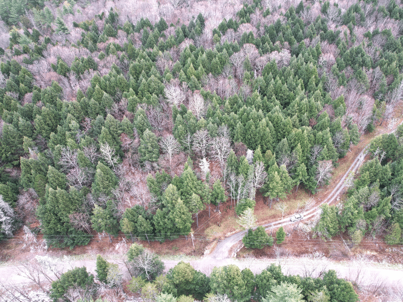
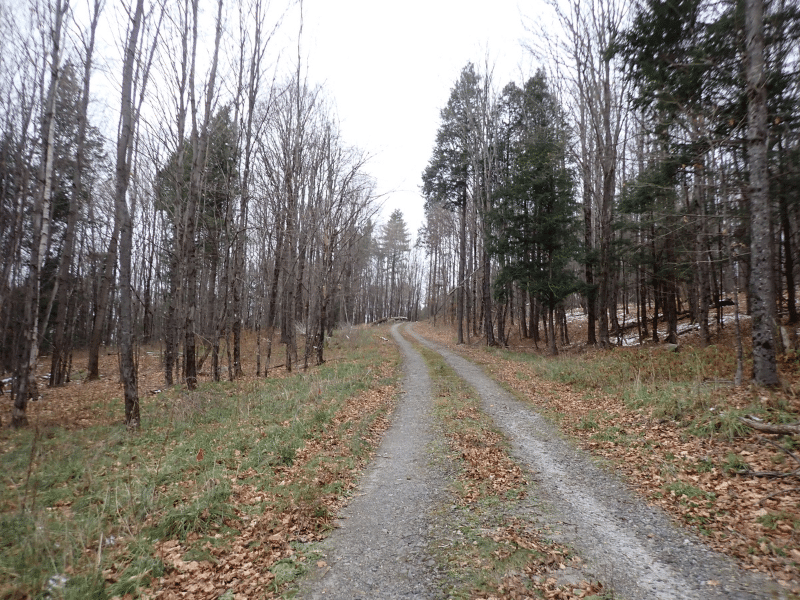
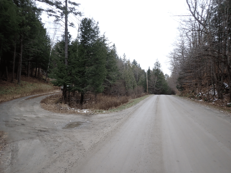
Access can be considered excellent with +/-835’ of frontage along East Hill Road, a town-maintained, graveled road, with electric power and telephone services roadside.
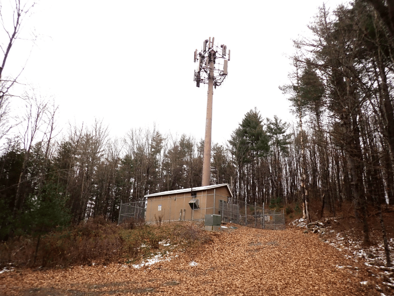
A high quality driveway enters the land from East Hill Road and proceeds 1,500’ to near the height of land. This gated road currently accesses the cell tower on the land but also serves as the perfect driveway to the potential homesite. Electric power is buried along this road facilitating a low cost electric option for the homesite.
Property Description
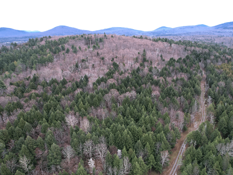
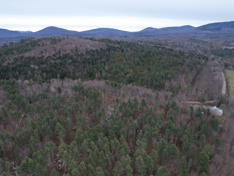
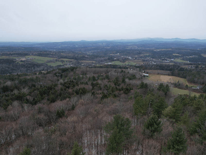
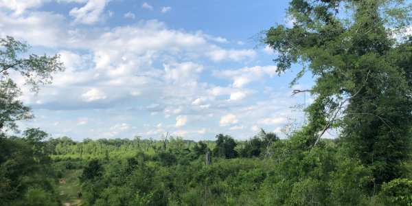
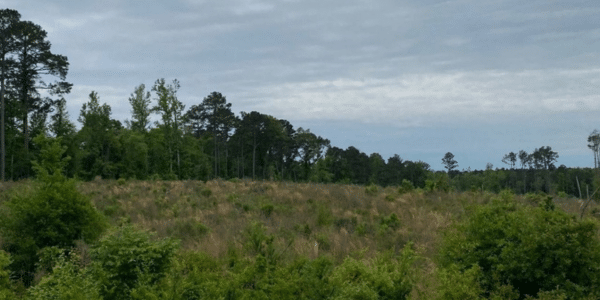
The land’s relatively high elevation provides attractive, potentially long views to the west of the Worcester Range, Paine Mountain and the Green Mountains. The height of elevation is 1,580’, occupying part of the top of Maple Hill, with the potential homesite just below this elevation, creating the view potential.
The land can be considered gently sloping with some steeper terrain in a few areas. The land along the town road represents the low point whose elevation is 1,320’. From here, terrain consistently rises to the east and to the top of Maple Hill.
Soils can be considered well drained and productive. Given the relatively high elevation, no year-round streams are on the land.
Various old stone walls run through the forestland. The entire property is forested with the exception of the access road, the cell tower foot print and a small clearing near the cell tower.
The land has NOT been tested and approved for septic use however soil conditions indicate the soils will likely support a septic system. The buyer should retain a soil engineer to determine if a septic can be designed for the buyers intended property uses.
A cell tower is located on the property near the height of land, at the end of the driveway. The property is subject to an existing cell tower lease and its related access and utility easements. Any rent derived from the cell tower lease shall not convey to the buyer as those rights will be reserved by the seller or conveyed to the cell tower tenant or a 3rd party through an easement and assignment of lease.
Timber Resource
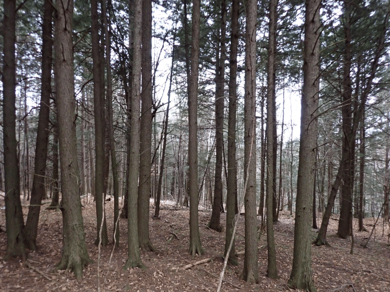
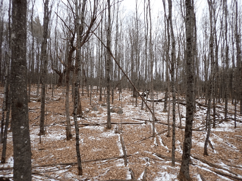
Forest aesthetics for the property can be considered excellent given the older age classes that exist whose high, dense canopies have created limited regeneration and plant growth in the understory making it easy to walk and see long distances.
The forest resource can be divided into two stand types, Stand 1 is on the lower slopes and is a dense hemlock stand which is +/- 90 years of age. The stand appears to be part of a deer-yard providing important white-tailed deer habitat in the winter
months. Stand 1 is a hardwood area on the mid and upper slopes where sugar maple is the dominant species. The stand age is
about 60 years old however scattered 150 year old legacy trees exist. A forest management plan is available upon request.
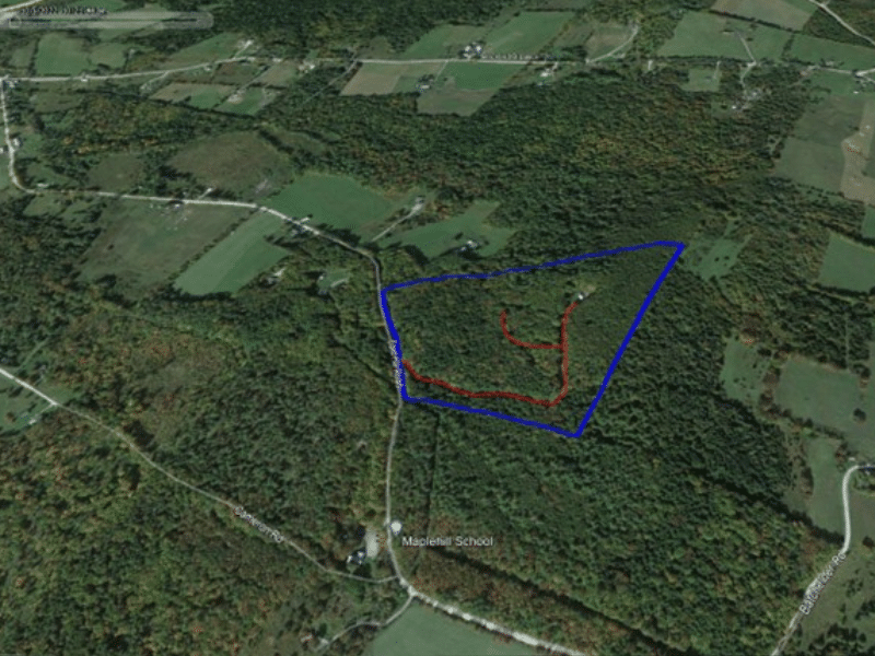
Parcel Map
Broker Disclosure: Under agency law, you are considered a customer, unless you have a written brokerage agreement with Fountains Land (in which case you are a client). While you are a customer, Fountains is NOT obligated to keep confidential the information that you might share with us; therefore, you should not reveal any information that could harm your bargaining position.

Thom Milke
NE Real Estate Manager & Vermont Principal Broker, REALTOR®
Contact Thom Milke
Resources
Maps
-
Google Earth IconGoogle Earth
-
Locus Map IconLocus Map
-
Topo Map IconTopo Map
-
IR Map IconIR Map
View Similar Properties
-
 AvailablePrice Varies By Parcel
Swanson Development
182 AcresMultiple UsesPerry, Houston County, GA -
 Price Improvement$60,630 $46,546
Powell Plantation Tract #1
4 AcresMultiple UsesDeBerry, Panola County, TX -
Price Improvement$38,310 $29,805
Powell Plantation Tract #2
2 AcresMultiple UsesDeBerry, Panola County, TX -
Price Improvement$37,485 $27,426
Powell Plantation Tract #3
2 AcresMultiple UsesDeBerry, Panola County, TX