South Warren Forest


Property Details
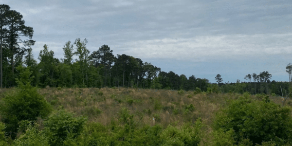
Property Overview
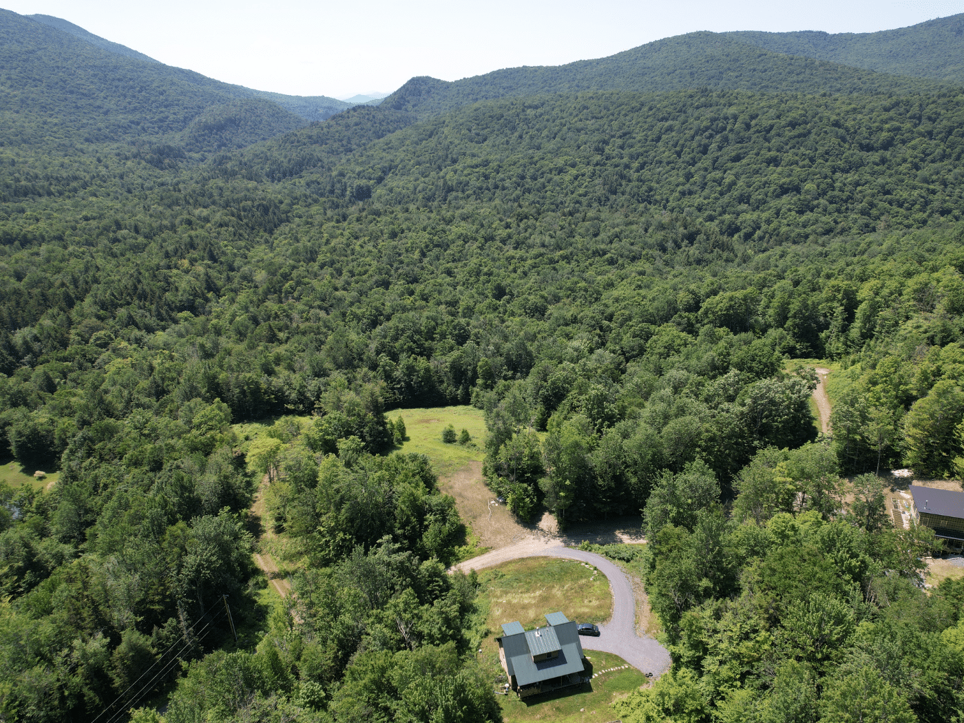
The property is well suited to buyers seeking to establish a large family compound in Warren with plenty of acreage to enjoy its private setting. The land abuts the Green Mountain National Forest, and is a short drive to Sugarbush Ski Resort, Blueberry Lake, and Warren Village. Key property highlights include:
Key property highlights include:
- Potential homesites near Southview Road and Plunkton Road.
- Views of Mount Adams with tree clearing.
- Bordered on the west by Green Mountain National Forest and on the south by lands of the State of Vermont.
Location
The property is situated along the southern end of Plunkton Road, which intersects with Southview Road. From there, travel north to the heart of Warre Village and scenic easterly highlands. The potential building sites are in an ideal location, very close to Route 100 and only 15 minutes from Sugarbush Resort. Blueberry Lake is within walking distance up the road, where you can boat, swim, or fish on a pristine, uncrowded lake. From the land, walking access is available to the adjacent Green Mountain National Forest, where tens of thousands of acres are available for recreational pursuits.
Boston is three hours away, and New York City is six hours. This area of central Vermont has much to offer, from restaurants and cultural amenities to outdoor pursuits. Burlington and Lake Champlain are an hour’s drive away.
Access
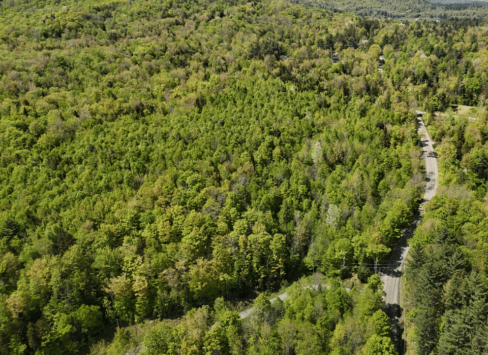
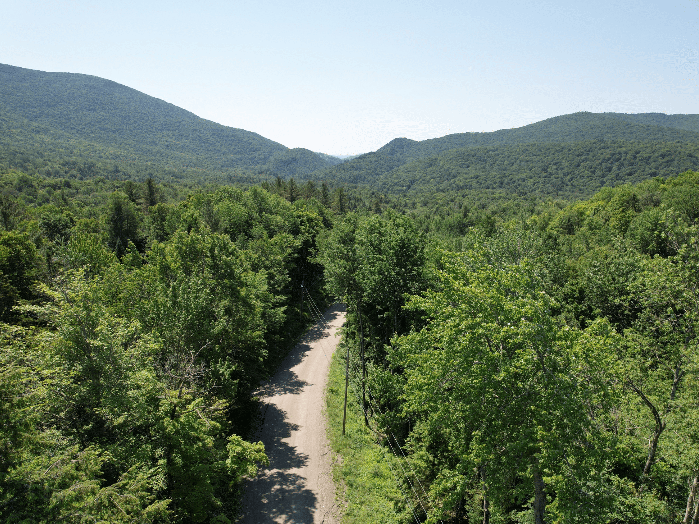
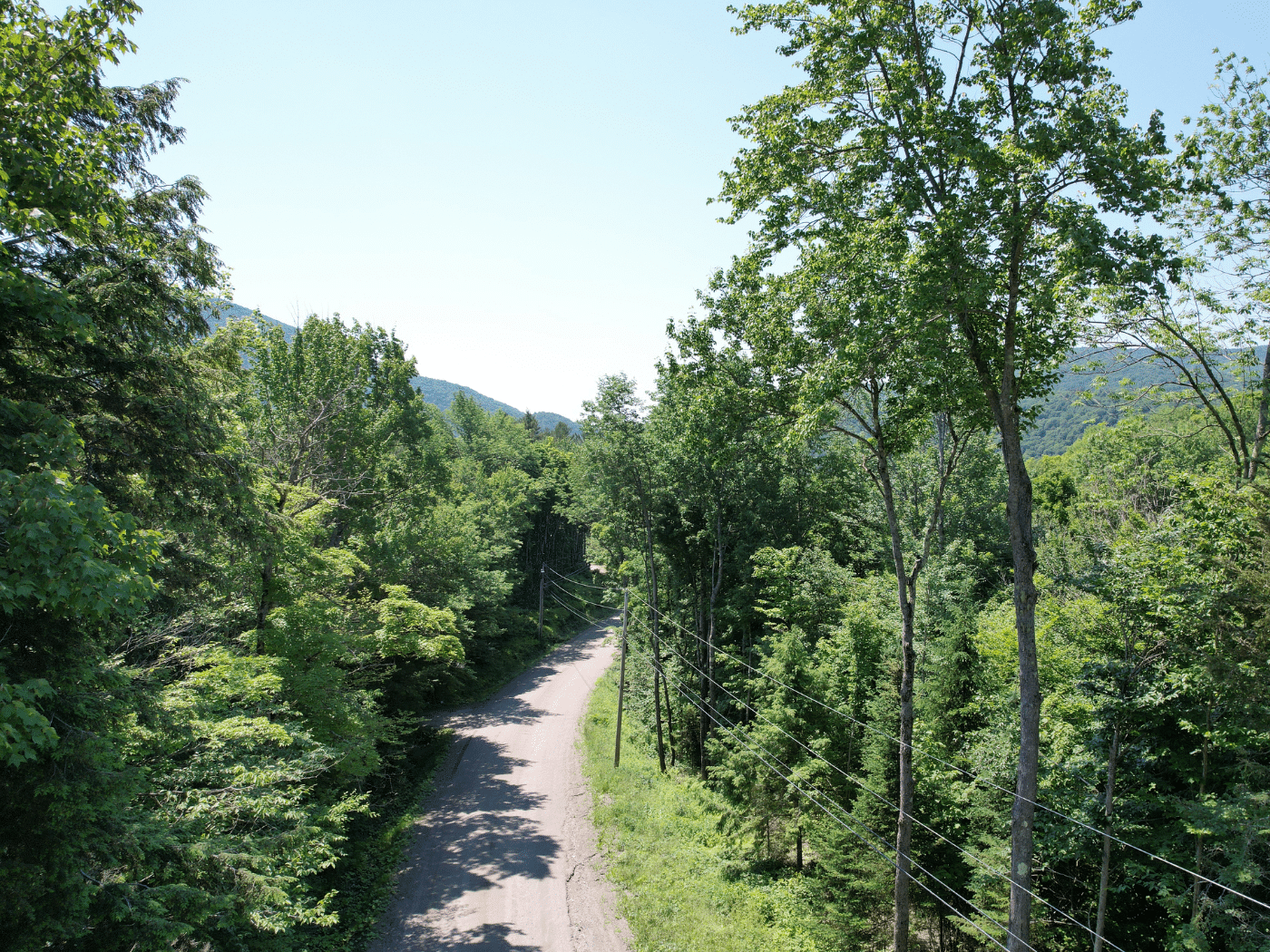
Access can be considered excellent with +/-660’ of frontage along Plunkton Road, a town-maintained, graveled road, with electric power and telephone services roadside. On Southview Road, there is an existing old driveway cut into the land that will support an internal road/driveway for future home development.
Property Description
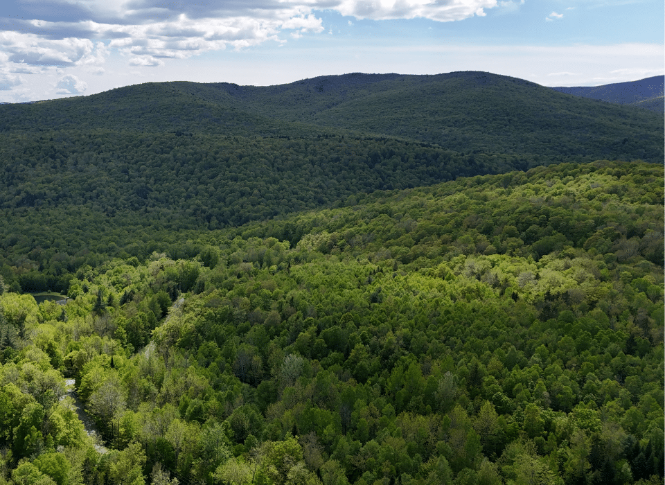
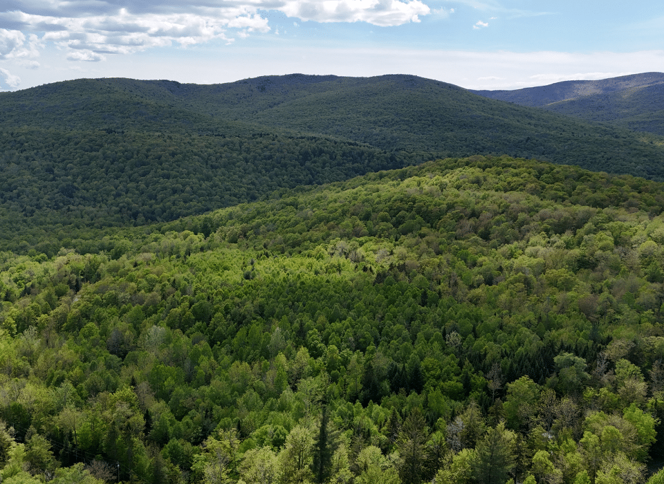
The land’s relatively high elevation (+/-1,600’) provides attractive, potential views to the southeast of Mount Adams, a nearby peak with an elevation of 3,180’, which lies along the Northfield Range, also in view with tree clearing.
The potential homesites offer an easterly to southeastern aspect covering gently sloping land with a few moderate slopes in between gentle benches. Soils in this area appear to be somewhat well-drained. One of two possible old driveways can be used to access these potential homesites, one off Plunkton Road and one off the beginning of Southview Road (see maps for location).
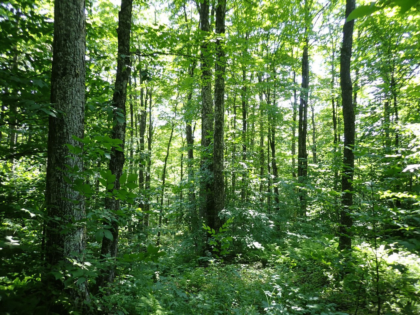
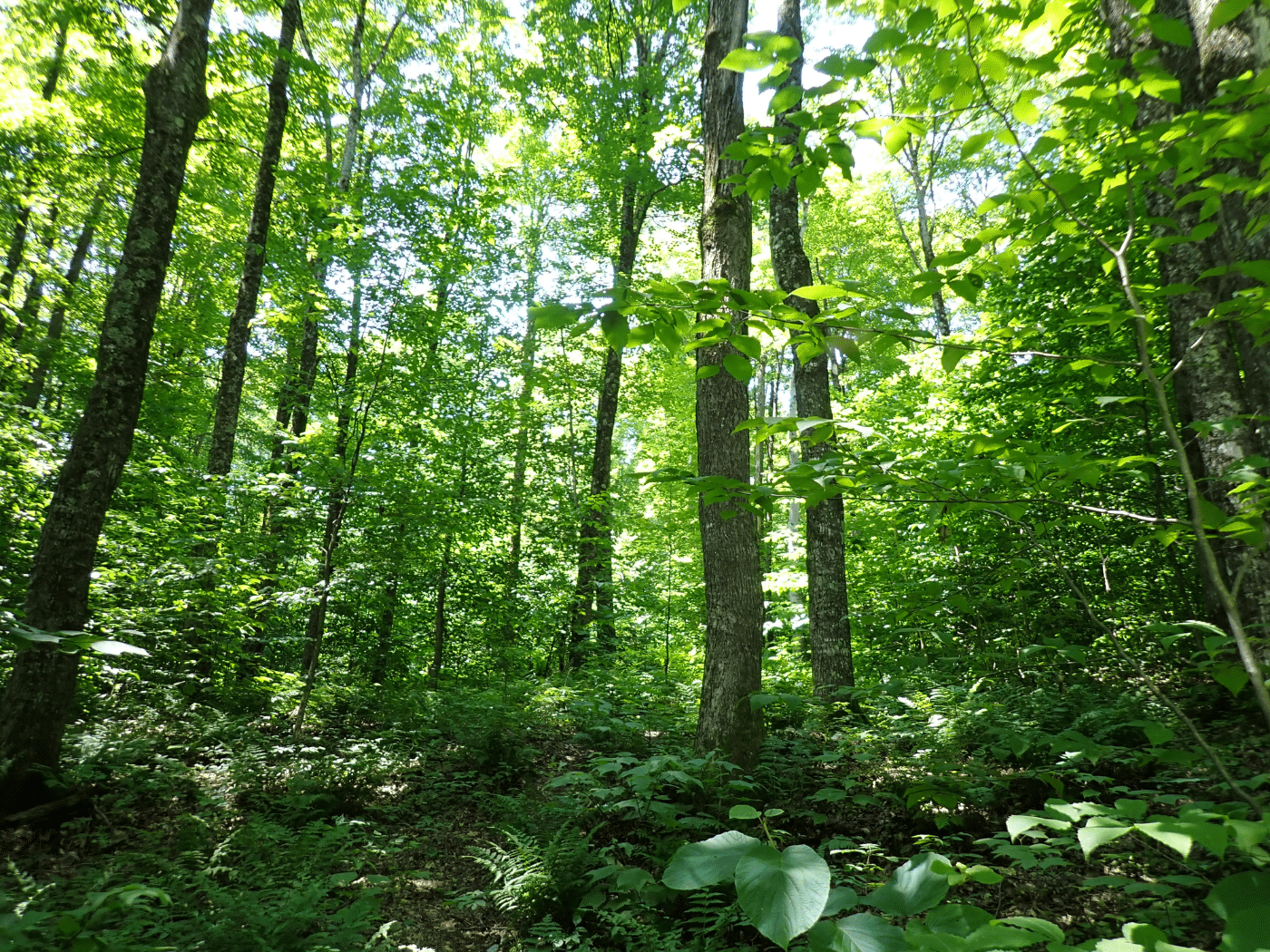
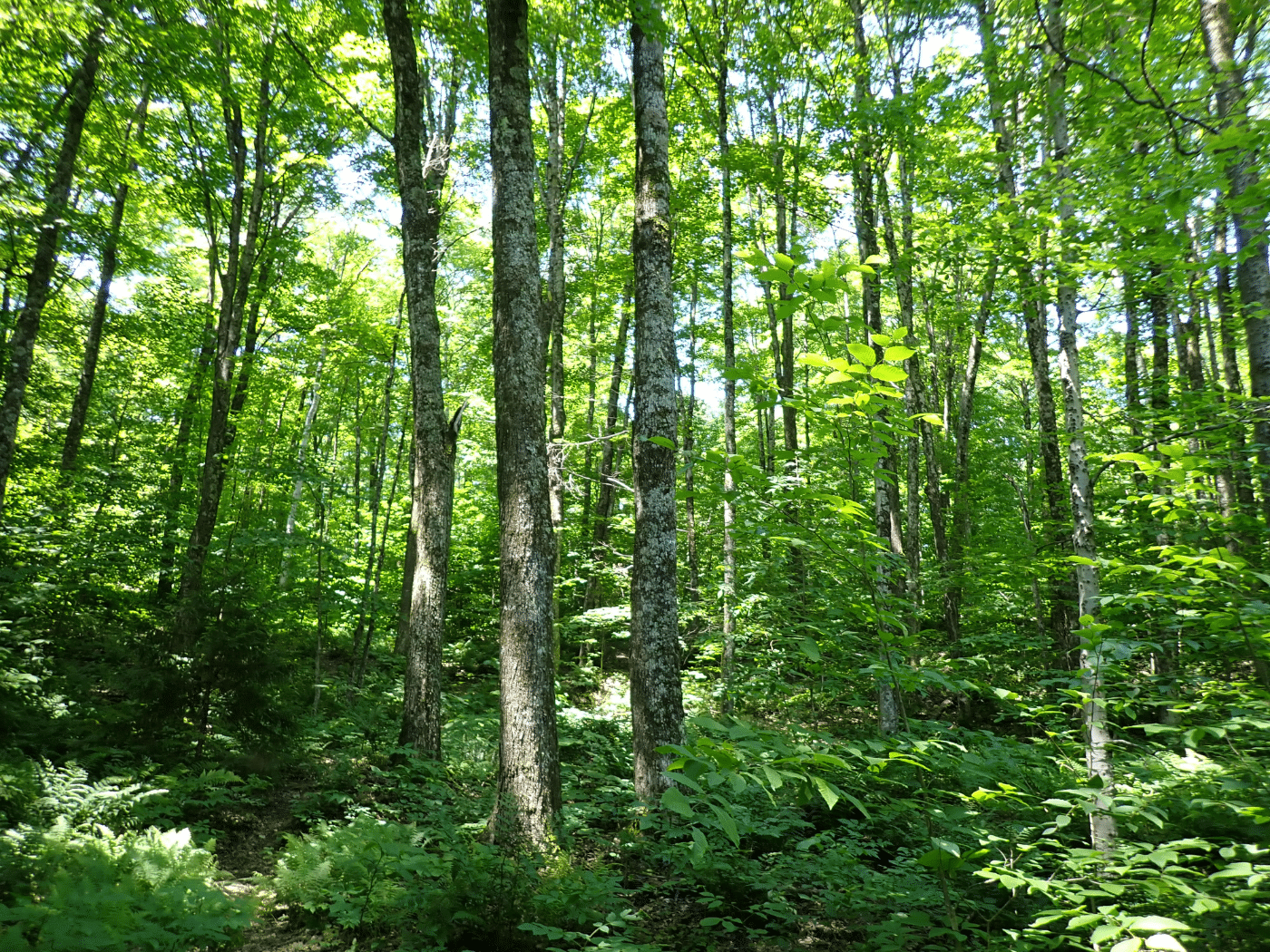
The northeastern corner of the land is relatively flat, supporting tall softwood trees on variable soil conditions with some wet areas. The west central area is the high point with an elevation of 1,700’, with a walking trail leading to the site. From this point south, the land falls off, covering variable terrain with rock outcrops in many areas, creating an attractive hiking destination.
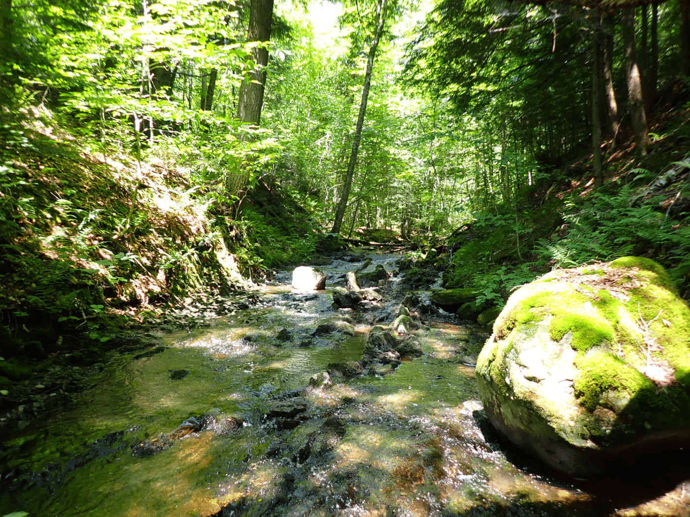
A year-round stream runs along the southeastern boundary. Another small stream drains through the land, creating small pools and tiny falls. The southern boundary runs along the Warren/Granville town line with Route 100 +/-300’ from the southern boundary.
Forest Resource
Forest aesthetics for the property can be considered highly attractive given the older age classes and dense overstory canopy; however, in the northwest area, a dense understory exists given the nature of the mostly softwood species composition, which can thrive in semi-light conditions. The western and southern hardwood stands are mature with large trees, while the area near the potential homesites has younger trees.
Parcel Map
Broker Disclosure: Under agency law, you are considered a customer, unless you have a written brokerage agreement with Fountains Land (in which case you are a client). While you are a customer, Fountains is NOT obligated to keep confidential the information that you might share with us; therefore, you should not reveal any information that could harm your bargaining position.

Thom Milke
NE Real Estate Manager & Vermont Principal Broker, REALTOR®
Contact Thom Milke
Resources
Maps
-
Google Earth IconGoogle Earth
-
Locus Map IconLocus Map
-
Topo Map IconTopo Map
-
IR Map IconIR Map
-
Photo Map IconPhoto Map
View Similar Properties
-
 AvailablePrice Varies By Parcel
Swanson Development
182 AcresMultiple UsesPerry, Houston County, GA -
 Available$105,000
Rolling Hills Ranch #36
11.95 AcresMultiple UsesPineland, San Augustine County, TX -
 Available$60,630
Powell Plantation Tract #1
4.042 AcresMultiple UsesDeBerry, Panola County, TX -
Available$38,310
Powell Plantation Tract #2
2.554 AcresMultiple UsesDeBerry, Panola County, TX