Keegan Hill Forest


Property Details
The property is controlled by a conservation easement held by the Adirondack Land Trust. Highlights of the easement language address three main categories, including residential use, recreational rights, and forest management guidelines. In summary, the easement will allow one year round residential structure (no larger than 3,000 square feet), a guest cottage, and an accessory building (no larger than 2,000 square feet) located within the pre-specified “Residential Area”.
Exclusive recreational rights are retained by the buyer. Timber harvesting and silvicultural operations will be permitted within the framework of a pre-approved written management plan addressing numerous conservation guidelines.
Location
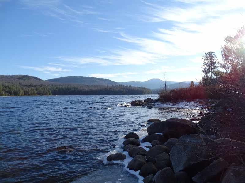
The property is located in the northeastern section of the Adirondack Park in the scenic Saranac River Valley. The Saranac River is a major Adirondack flow which originates west of Saranac Village and winds its way to Lake Champlain. The forest sits 1,200’ from the western shore of Union Falls Pond, within a quiet, rural area with much of the surrounding land base held as NY State Forest Preserve and lager private forest holdings. Many of the homes and camps in this area are seasonal and clustered near Union Falls Pond, a popular fishing and canoeing destination.
Union Falls Pond is a dammed section of the Saranac River which covers nearly 1,700 acres whose length is about 6 miles long providing important Bald Eagle habitat.
Lake Placid Village is situated 19 miles to the south while Saranac Lake, one of the largest communities in Franklin County (population 4,900), lies 15 miles to the southwest. Plattsburgh and Lake Champlain are situated 45 minutes to the east.
Albany, the state’s capital and home of the Albany International Airport is a 3-hour drive. New York City is roughly a 6-hour drive while Montreal, Canada is nearly a 2-hour drive.
Access
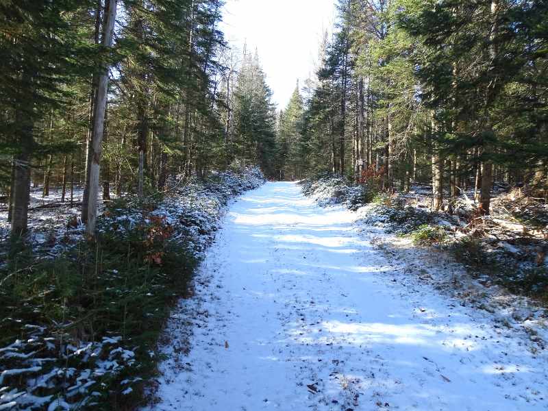
Access to the property is provided by a 750’ long right of way road that originates at Rock Street to the east and enters the land at its easterly corner. This road is gravel-based and crosses a neighboring parcel over gentle terrain before reaching the eastern boundary. Once at the property, the road transitions into a four-wheel drive jeep trail which continues westerly along the land’s boundary for roughly 1,200’. Internal access is complimented by a well-established hiking trail that extends roughly 800’ west from the end of the afore mentioned jeep trail.
The 53,280-acre Taylor Pond Wild Forest abuts the property’s western boundary, significantly expanding the property’s recreational reach.
Electric power and telephone services are available along Rock Street, 750’ from the property boundary.
Property Description
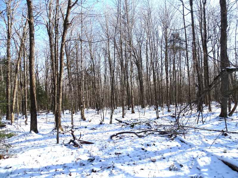
The parcel is situated in a heavily forested basin south of Keegan Hill (Elevation 1,875’), an expansive hardwood ridge overlooking the western shore of Union Falls Pond. Overall, the property can be categorized into two main components. The first section of the tract comprises a 17.72-acre area located east of a utility line right of way. This zone has been designated as the “Residential Area” under the terms of the conservation easement. This building envelope is comprised of gentle topography and moderately drained soils with reasonably close proximity to utilities.
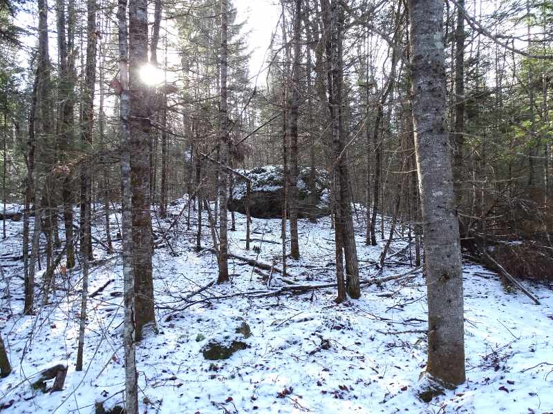
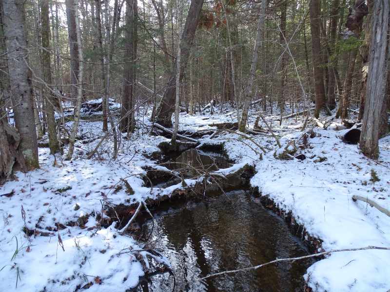
The remaining 158 acres is situated west of the utility right of way. This area is comprised of a large, forested saddle situated between Keegan Hill to the north and Burnt Hill to the west. Terrain here is mostly gentle with moderate to at times, poorly drained soils. Due in part to the nearby mature timber stands located on adjacent State Lands, this section of the forest is frequented by large mammals such as white-tailed deer, moose, and black bear. Other smaller mammals and amphibians frequent the alder-lined stream that flows through this area eastward into Union Falls Pond. Elevation property wide ranges from 1,410’ above sea level (ASL) along the road frontage to 1,560’ ASL near the western boundary.
Timber Resource
Approximately 95% of the property is forested, with the balance covering roads, trails, and clearings. The forest is dominated by a softwood overstory (approximately 75% of total volume) with interspersed northern hardwoods found throughout the canopy. A 40+/- acre hardwood dominated stand exist at the property’s southwestern corner. Primary species forest-wide include red spruce, balsam fir and eastern hemlock, while major hardwood species include sugar maple, red maple, yellow birch, and beech.
Tree diameters consist of a mix of poles and small to medium sized sawlogs. Stem quality is generally very good for the spruce/fir, and average for the hardwoods which occur generally on off-site, poorly drained soils. Overall, fully stocked stand conditions prevail throughout the forest. With a dense overstory canopy in place, forest aesthetics are attractive, complimenting the recreational opportunity. Given current stocking levels, species composition, and diameter distribution, income generation through harvest and thinning is possible anytime.
Parcel Map
Broker Disclosure: Under agency law, you are considered a customer, unless you have a written brokerage agreement with Fountains Land (in which case you are a client). While you are a customer, Fountains is NOT obligated to keep confidential the information that you might share with us; therefore, you should not reveal any information that could harm your bargaining position.

Tom Gilman, CF
New York Regional Manager & Real Estate Agent
Contact Tom Gilman
Resources
Maps
-
Google Earth IconGoogle Earth
-
Locus Map IconLocus Map
-
Topo Map IconTopo Map
-
IR Map IconIR Map
View Similar Properties
-
 AvailablePrice Varies By Parcel
Swanson Development
182 AcresMultiple UsesPerry, Houston County, GA -
 Price Improvement$60,630 $46,546
Powell Plantation Tract #1
4 AcresMultiple UsesDeBerry, Panola County, TX -
Price Improvement$38,310 $29,805
Powell Plantation Tract #2
2 AcresMultiple UsesDeBerry, Panola County, TX -
Price Improvement$37,485 $27,426
Powell Plantation Tract #3
2 AcresMultiple UsesDeBerry, Panola County, TX